Showing posts with label technical. Show all posts

Sunday, 8 January 2012

16 - Huia Dam Rd, Nugget and Twin Peaks Tracks (Huia)

Huia Dam Road

Nugget Track


View of Manukau Harbour on a rainy summers day from Twin Peaks Track

                                                                                                                        
Loop: 16 - Huia Dam Rd, Nugget and Twin Peaks Tracks
Region: Huia
Access Point: Huia Road
Coordinates: -36.99589 174.56647
Track #
Track Name
Distance (km)
63
Huia Dam Road
6
134
68
Nugget Track
Huia Ridge Track
2
0.3
70
Twin Peaks Track
4.8
Map Distance
Measured Distance
13.1
13.4
                                                                                                                        
Completed: Solo on 7 JAN 2012

63. Huia Dam Road
keywords:
Runnable, non-technical, gravel road, easy to medium slope, partially bush-covered, view (Upper and Lower Huia Dams).
comments:
A gravel track of a consistent slope with only a couple of steep sections to contend with. A nice 12 km out and back that links both Upper and Lower Huia Dams.

134. Nugget Track
keywords:
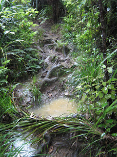
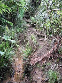
Runnable (partially), technical, knee and head high vegetation, roots, hands required, mud/dirt/clay surface, slippery (when wet), single-track, well-marked, steep slope, mostly bush covered.
comments:
This is a long and steep 2 km climb from Upper Huia Dam to Huia Ridge. Probably quite enjoyable coming down but its a rough track, very slippery and only walkable in the wet.
                                                                                                                        
Top Section
70. Twin Peaks Track
keywords:
Runnable (mostly), technical, knee and head high vegetation, roots, rocks, hands required, mud/dirt/clay surface, slippery (when wet), single-track, well-marked, steep slope, bush-covered, view (Manukau Harbour).
comments:
In the wet it is very slippery, muddy and prone to flooding. There is a big elevation gain/loss so be mentally prepared for that. You also visit the highest point in the Waitakere Ranges (Te Toiokawharu, (459 m on sign/474 m on topo)) but there is no view to be had just here, however, you are rewarded for your efforts further along. A long and rather enjoyable track, probably better appreciated in dry conditions.
                                                                                                                        

Topo Map (click to enlarge)
Elevation Profile - Huia Dam Road and Nugget Track

Elevation Profile - Twin Peaks Track 


Huia Dam Road

Nugget Track

Twin Peaks Track

Twin Peaks Track

Friday, 6 January 2012

9 - Huia Ridge Track (Piha)


Loop: 9 - Huia Ridge Track
Region: Piha
Access Point: Piha Road
Coordinates: -36.96829 174.51507
Track #
Track Name
Distance (km)
68
Huia Ridge Track
6
68
return Huia Ridge Track
6
Map Distance
Measured Distance
12.0
12.3
                                                                                                                        
Completed: Solo on 5 JAN 2012

68. Huia Ridge Track
keywords:
Mostly unrunnable, technical, knee and head high vegetation, roots, hands required, mud/dirt, slippery, single-track, mostly well-marked, steep slope, bush-covered.
comments:
This long out and back track is mostly unrunnable due to the highly uneven and root ridden surface, the steep slope and the mud. The only opportunity to stretch the legs came on a 300 m section of boardwalk. However, the 3 km section to Piha Rd from the Nugget Track junction is pure pleasure and erases the frustrations of the 9 km that went before. Would recommend this section on its own as a test of downhill nimbleness. Overall this track is an exercise in foot/eye coordination and quadricep strength, and suitable as a walk rather than a run.

Topo Map (click to enlarge)

Elevation Profile (click to enlarge)

View 9 Huia Ridge Track in a larger map


Tuesday, 27 December 2011

14 - Waitakere Dam and Tramline Walk, West Tunnel Mouth, Anderson, Auckland City Walk and Fenceline (north) Tracks (Cascades)

Waitakere Dam Walk

Waitakere Tramline Walk

Waitakere Dam and Reservoir
                                                                                                                        

Loop: 14 - Waitakere Dam and Tramline Walk, West Tunnel Mouth, Anderson, Auckland City Walk and Fenceline (north) Tracks
Region: Cascades
Access Point: Scenic Drive
Coordinates: -36.90012 174.54278
Track #
Track Name
Distance
116
Waitakere Dam Walk
1.4
23
Waitakere Tramline Walk
1.6
30
West Tunnel Mouth Track
0.4
18
Anderson Track Southern Access
0.7
-
Scenic Drive
0.3
18
Anderson Track Northern Access
2.3
16
Auckland City Walk
1.5
19
Fenceline Track (north)
1.4
116
return Waitakere Dam Walk
1.4
Map Distance
Measured Distance
11.0
11.3
                                                                                                                        
Completed: Solo on 27 DEC 2011

116. Waitakere Dam Walk
keywords:
Runnable, non-technical, tar-seal, well-marked, medium to steep, not covered, view (Waitakere Dam).
comments:
An extremely smooth surface ideal for running with a stroller.

23. Waitakere Tramline Walk
keywords:
Runnable, non-technical, tram-tracks, gravel, single-track (alongside tram-tracks), well-marked, flat, stairs (few), bush-covered, view (tunnel).
comments:
A flat and easy gravel run on a narrow strip that runs along side the tram-tracks. Take care, as the tracks can still trip you up somehow. Also, watch your head in the tunnel.

30. West Tunnel Mouth Track
keywords:
Runnable, technical, rocks, roots, dirt surface, single-track, well-marked, steep slope, bush-covered.
comments:
A short, steep and gnarly track with roots and rocks underfoot. Its over before you have warmed up to it.

16. Auckland City Walk
keywords:
Runnable, non-technical, gravel/dirt, wide, well-marked, easy slope, bush-covered, view (kauri and other natives).
comments:
An extremely well utilised, even-surfaced track. A very easy 1.5 km loop that can add distance to any of the other tracks that feed off this one.

19. Fenceline Track (north)
keywords:
Runnable, technical, roots, dirt/mud, single-track, well-marked, steep slope, stairs (few), bush-covered.
comments:
This track is a bit of a mess but ideal for the trail runner over the Sunday stroller. Stairs, roots and mud galore, and its steep. Great fun. 
                                                                                                                        
Top Section
18. Anderson Track
keywords:
Runnable, technical, roots, rocks, dirt/mud, river-crossing, single-track but wider in places, well-marked, steep slope, stairs (large quantity), bush-covered.
comments:
A good balance of technical and non-technical sections on this track, and a satisfying abundance of stairs. 


Topo Map (click to enlarge)
Elevation Profile (click to enlarge)


West Tunnel Mouth Track

Anderson Track


Anderson Track

Anderson Track


Fenceline Track (north)

Fenceline Track (north)


Auckland City Walk

Monday, 21 November 2011

10 - Lake Wainamu and Houghton Tracks (Bethells - Te Henga)

Lake Wainamu Track
Houghton Track
Lake Wainamu and Smythe Ridge
                                                                                                                        
Loop: 10 - Lake Wainamu and Houghton Tracks
Region: Bethells - Te Henga
Access Point: Bethells Rd
Coordinates: -36.88391 174.45266
Track #
Track Name
Distance (km)
132
Lake Wainamu Track (clockwise)
4.0
131
Houghton Track
2.1
131
return Houghton Track
2.1
132
Lake Wainamu Track (clockwise)
3.1

Map Distance
11.3
Measured Distance
11.7
                                                                                                                        
Completed: Solo on 18 NOV 2011

131. Houghton Track
keywords:
Runnable, technical, rocks, roots, dirt, narrow, well-marked, steep slope, bush-covered.
comments:
A relentless 2 km steep rise to Smyth Ridge with plenty of obstacles underfoot. Ignore the lesser-formed side tracks as they lead to private property. This track is part of the Hillary trail.

                                                                                                                        
Top Section
132. Lake Wainamu Track
keywords:  
runnable, non-technical, sand/grass/dirt/gravel, wide with some single-track, well-marked, flat, open, view (waterfalls, dunes and Lake Wainamu).
comments: 
A flat and open loop track around Lake Wainamu taking in some stunning and unique scenery. You can intensify this run by ascending the dunes or choosing the loose sandy sections as terrain. A small side-trip will reveal a set of water-falls. Part of the Lake Wainamu loop is included in the Hillary trail.
                                                                                                                        

Topo Map (click to enlarge)
Elevation Profile (click to enlarge)


Lake Wainamu Track
Lake Wainamu Track

Lake Wainamu Track
Houghton Track

Saturday, 12 November 2011

2 - Te Henga Walkway (Bethells-Te Henga)


Loop:2 - Te-Henga Walkway
Region:Bethells - Te Henga
Access Point:Constable Road
Coordinates:-36.84880 174.44373
Track #
Track Name
Distance (km)
142
Te Henga-Goldie Bush Walkway (west)
8.8
142
return Te Henga-Goldie Bush Walkway (west)
8.8
Map Distance
Measured Distance
17.6
19.0
                                                                                                                        
Completed: Solo on 12 NOV 2011


142. Te Henga-Goldie Bush Walkway (west)
keywords:
Runnable (mostly), technical, knee and head high vegetation, uneven dirt/grass surface, slippery (when wet), single-track, well-marked, steep to medium slope, stairs (few), exposed, view (west coastline)
comments:
An extremely challenging, highly technical cliff run. A combination of flax, gorse, and long grass as well as hidden uneven surfaces, make sections of this track very frustrating to run. The trail veers and slopes towards a steep drop on occasion and is suffering from erosion. And of course there's the stunning view to tempt your eyes from the track, which may have consequences. Out and back - its a long run! There is a steep ascent from Bethells Beach to the ridge line and up to Constable Road, with undulating ground in-between, traversing headlands and bays. Just stunning!

Topo Map (click to enlarge)
Elevation Profile (click to enlarge)

View 2 Te Henga Walkway in a larger map