Before I head off on a 10 week adventure out of Auckland, and away from the Waitakeres, a quick status update is in order. I was hoping to reach 50 % completion before I left, but not quite.
Over the past 4 months I have run/walked 47 % of the Waitakere Track distance on 20 individual adventures into the ranges. Being a little selective with the loop I choose to run, I find I am now left with long loops, that are far away from my home location hence a great deal more effort and motivation is required to get myself out the door.
Combined with the fact I am now training for the T42 off-road marathon in May, I continually find that type and length of tracks doesnt quite match what is required in my training programme, so I tend to be running more in Riverhead forest and Okura Bush Walkway.
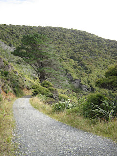
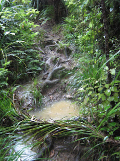
Also, the more I run in the Waitakeres, the more I realise that the majority of the tracks arent actually that runnable. Despite undertaking this in 2011/2012 summer period, I continually find the tracks are boggy and flooded, and the technical nature and rooty terrain is more conducive to walking and/or doing an ankle. Nevertheless, the objective of this exercise was to identify which of the tracks are actually runnable, and in the end, I hope that I will elucidate that.
Now, the stats:
Number of loops completed: 20 loops / 41 loops
Percentage of map distance completed: 47 %
Map distance of loops completed: 188 km / 399 km
Actual distance run (by GPS): 175 km
Longest Run - 2 Te Henga Walkway: 19 km
Shortest Run - 21 Anawhata Beach Track and Hettig Track: 2.1 km
Average Run: 9.2 km
Top Track: Long Road Track
Top 10 Tracks: see here
Total Travel: 1047 km
Quantity of data generated: TBC mb
Number of photos captured: TBC photos
 |
| Conquering the Waitakere Trails - 47 % complete (click to enlarge) |
And so, until I return in April! Get off the couch!


